An overview of Paris geography will show that it is a relatively flat place. Other than the hill of Montmarte the terrain of Paris changes rather less than a ten story building.
This makes Paris an easy city to walk around and allows you to save your energy for hiking up the stairs of the Eiffel Tower if you choose, or for investigating the miles of halls in the Musee de Louvre.
Paris is oval shaped, approximately 9 miles East to West and 6 miles North to South. There is a road, known as the Periphique, or Perimeter Road that separates Paris proper from the banlieu or suburbs. It is about 22 miles around the Periphique.
The River Seine cuts an arc across Paris, flowing from the Southeast to the Southwest. It is on the islands and along the banks of the Seine that the City grew, so it is there that you will find the oldest areas of Paris and the main tourist attractions.
The North side of the river is called the Right Bank or Rive Droite(say "reeve dwat") and the South side of the river is called the Left Bank or the Rive Gauche (say "reeve go-shh") If you are directionally impaired, look into the river and face with the water going away from you. You are facing downstream. The Left Bank is on your left and the Right Bank is on your right. See, didn't I promise you good information?
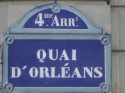
Paris is divided into 20 sections called Arrondissements and they are numbered 1 to 20. The first and oldest arrondissement, the center of the city includes a goodly portion of the Ile de la Cite (say "eel day la sit-ay"), and the near Right Bank.